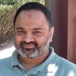
 Hi, my name is Mohammad Moinuddin Farooqui. Thank you for visiting my website and for your interest in learning more about me.
I am a GIS Vector Data Specialist, continually seeking to expand my knowledge and apply my expertise in spatial analysis, vector data development, and management to advance my professional career.
After spending more than 30 years learning and gaining experience in GIS, I have launched my website. I will use this platform to share my knowledge of GIS and geography with young people and beginners who have chosen GIS and/or Geography as their career path.
I have vast experience in GIS data collection, creation, manipulation, updates, and maintenance. I am a creative problem solver, always looking at things from a different perspective. I can quickly grasp complex technical issues and swiftly identify their cause by developing an effective GIS solution. I always enjoy utilizing my spatial analysis skills to find GIS solutions and love helping the community.
My Academic Background
I’m a Gold Medalist in Geography. I received my Bachelor’s and Master’s degrees from the University of Karachi. Apart from Geography as a major subject, Physics and Mathematics were my minors.
My Story
During my studies, I also worked as a Research Assistant on using Remote Sensing and GIS techniques to forecast the malaria vector in Karachi and its environs, in collaboration with the University of Georgia, Athens, USA.
It was the first time I used the ArcView and ERDAS Imagine applications. I still remember the time when I digitized the Karachi district boundaries and malaria zones, and had to go through various procedures to clean those shapefiles using PC ArcInfo, a DOS-based GIS platform.
Time has passed very quickly. Since then, I have worked on all versions of ArcView, ranging from 2.1 to 3.3, and then ArcGIS, from 8 to 10.8.1 to date, although ArcGIS Pro is the latest released version available on the market.
I also learned image processing, georeferencing, rectification, and mosaicking using ERDAS Imagine 8.1. I am also excited to learn new things today, so I continuously expand my knowledge and skills.
I always encourage youngsters to attend ESRI online training courses as they are one of the best platforms for learning GIS.
My Professional Career
I began my professional career as a Geographer in June 1996 at Engineering Consultants International (Pvt) Limited (ECIL), Karachi, where I worked on various projects utilizing ArcView and ERDAS Imagine to visualize, create, process, manage, and analyze geographic data.
After working for four years at ECIL, I moved to Dubai in June 2000 and joined Spatial Data Integrators (SDI), where I worked for three years. I then shifted to MAPS Geosystems, SDI’s parent company, in Sharjah.
Here at MAPS, I was fortunate to work with and learn from great GIS professionals. I restarted my learning phase by joining numerous in-house instructor-led courses.
I also joined the ESRI online training center, attended many webinars, and completed self-paced online courses. I always encourage youngsters to attend ESRI online courses, as they are one of the best platforms for learning GIS.
In May 2008, I left MAPS, which was then acquired by FUGRO, the Dutch surveying company. I joined the Emirates Telecommunication Corporation (Etisalat) in the same month in Dubai. Since then, I have served Etisalat as a catalyst in many utility-based projects. You can explore more about me and my work throughout the website.
Thank you once again!
For any queries, please feel free to contact me at your convenience. I would be happy to answer your questions.
Best Regards,
Mohammad M. Farooqui