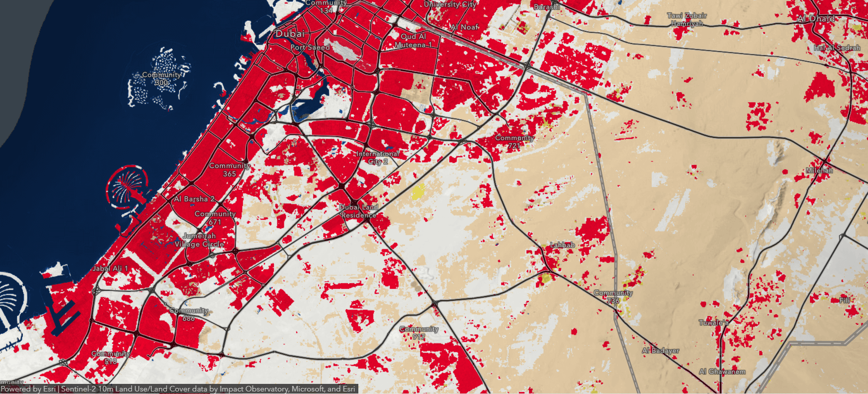
The rapid advancements in Artificial Intelligence (AI) have revolutionized countless industries, and Geographic Information Systems (GIS) are no exception. The integration of AI in GIS has led to unprecedented improvements in the management, processing, and analysis of geospatial data, particularly in vector data automation. In this article, we will explore how AI in GIS can be harnessed to streamline vector data automation, unlocking new potential and driving your business to new heights of success.
The Power of AI in GIS: Transforming Vector Data Automation
Integrating Artificial Intelligence (AI) into Geographic Information Systems (GIS) has revolutionized how spatial data is processed, analyzed, and visualized. One of the key areas where AI has had a significant impact is in automating vector data processing tasks. This has improved efficiency, accuracy, and decision-making capabilities in various industries, including urban planning, environmental management, transportation, and disaster management.
Some automating GIS vector data processing tasks:
1. Feature extraction and classification:
AI algorithms, such as deep learning-based convolutional neural networks (CNNs), have made it possible to automate the extraction and classification of features from satellite imagery and aerial photographs. By training models on labeled datasets, AI can identify and classify various features, such as roads, buildings, water bodies, and vegetation, with high accuracy. This significantly reduces the time and effort required for manual digitization and classification of features in vector data.
2. Object detection and tracking:
AI-powered object detection and tracking algorithms can analyze vector data to identify and monitor objects of interest. For instance, these algorithms can track the movement of vehicles, monitor wildlife migration patterns, or identify changes in land use over time. This capability is crucial for various applications, such as traffic management, wildlife conservation, and monitoring deforestation.
3. Data quality improvement:
AI can detect and correct errors in vector data, such as missing or misplaced features, incorrect attribute values, and topological inconsistencies. Machine learning algorithms can analyze large datasets and learn patterns to detect anomalies or inconsistencies, allowing for the automated correction of errors and improving the overall quality and reliability of GIS data.
4. Spatial pattern recognition and analysis:
AI algorithms can identify and analyze complex spatial patterns within vector data, which can be useful in various applications, such as urban planning, crime analysis, and environmental assessment. By recognizing patterns and relationships among spatial features, AI can provide valuable insights and inform decision-making processes.
5. Predictive modeling and simulation:
AI can be utilized in GIS to develop predictive models and simulate scenarios based on spatial data. For example, AI-driven models can predict the spread of wildfires, estimate the impacts of climate change on land use, or assess the effects of urban development on traffic patterns. These models enable better decision-making by providing accurate predictions and simulations of future events and their potential impacts.
6. Automated routing and optimization:
AI algorithms can optimize transportation networks by analyzing vector data related to roads, public transportation, and other infrastructures. Using AI, optimal routes can be determined for various purposes, such as emergency response, logistics, and commute optimization.
7. Change detection and monitoring:
AI algorithms can efficiently analyze time-series vector data to identify changes and monitor developments in the landscape, such as urban expansion, deforestation, or natural disasters. By comparing vector datasets from different time periods, AI can automatically detect significant changes and provide valuable insights for decision-makers in various fields, such as land management and disaster response.
8. Natural language processing for geospatial data:
AI-powered natural language processing (NLP) techniques can help to extract and analyze geospatial information from textual sources, such as social media posts, news articles, and scientific publications. By processing large volumes of unstructured text data, AI can identify and link relevant geospatial information, providing valuable context to vector data and improving the overall understanding of spatial relationships and trends.
9. Real-time data processing and analysis:
AI can enable real-time processing and analysis of vector data streams, such as those generated by IoT devices, sensors, and social media. This capability allows for timely decision-making and response in various applications, such as traffic management, environmental monitoring, and emergency response.
10. Integration of multi-source data:
AI can seamlessly integrate and analyze vector data from diverse sources, such as satellite imagery, aerial photographs, LiDAR, and ground-based sensors. By combining and processing these datasets, AI can generate comprehensive geospatial information and provide a more accurate and holistic understanding of the environment and its dynamics.
Conclusion:
Integrating AI in GIS has transformed vector data automation, significantly improving data processing, analysis, and visualization. As AI algorithms continue to advance, we can expect further enhancements in the capabilities of GIS, enabling more efficient and informed decision-making across a wide range of industries and applications.
